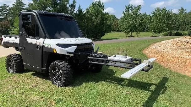
Multi-modal soil sensor suite that measures soil compaction to a depth of 24 inches (several feet) while also capturing real-time data on soil texture, carbon content, conductivity, moisture, and nutrient properties. Combines sensor data with physical soil samples and proprietary machine learning models to deliver high-resolution, highly accurate soil maps. Results are delivered through a cloud-based dashboard platform that integrates soil biological, physical, and chemical data to support agronomic planning, fertility prescriptions, and carbon measurement programs.
The full profile is free
Create a free account to see every specification, classification, autonomy, crops, regions, data practices, pricing model, plus similar products. No card required.
Every listing is factual, neutral, and compiled from publicly available sources, never sponsored. Logos are used for identification only and remain the property of their respective owners. How the Atlas works.